
By Patrick Lapinski
The Lake Superior National Estuarine Research Reserve
Serves Many Human and Natural Communities
The Lake Superior National Estuarine Research Reserve, headquartered on Barker’s Island at 14 Marina Drive in Superior, celebrated its 10th anniversary in 2020 – a milestone achievement for the freshwater ecosystem located in our own backyard.
The roughly 16,000-acre Reserve is one of two National Estuarine Research Reserves on the Great Lakes and part of the National Estuarine Research Reserve System (NERRS), a network of 29 reserves administered by the U.S. Department of Commerce and the National Oceanic and Atmospheric Administration (NOAA).
NERRS originated from the establishment of the Coastal Zone Management Act in 1972 to encourage states to “enhance public awareness and understanding of estuarine areas.” Through NERRS, community, state and federal partnerships are built to promote stewardship and management of estuarine and coastal habitats.
The Lake Superior Reserve is one of the newest in the system, established in 2010. The Great Lakes’ other site, Old Woman Creek on Lake Erie, was established much earlier in 1980. So the Lake Superior Reserve is undoubtedly in rarified company, and the partners associated with the Reserve in northern Wisconsin can be justly proud of it.
The Great Lakes contain more than 20 percent of the Earth’s surface freshwater, and Lake Superior, the world’s largest freshwater lake by surface area, still holds its title as the cleanest among them. The lake is is inextricably entwined with the St. Louis River, so the Research Reserve’s research and education programs are important. Monitoring and protecting water quality and coastal shorelines is vital to the health of fish and wildlife.
“It’s at the very tip-top of so much freshwater and so many international communities.”
– Reserve Interim Manager Deanna Erickson
It’s also important to local businesses and industries large and small – from commodities shipping through our port to businesses serving the tourism industry including hotels, restaurants, breweries and pubs, fishing and recreation gear shops, and boat and recreational vehicle businesses.
Facilities and Staff
The Lake Superior Research Reserve’s two buildings on Barker’s Island are home to its administrative offices as well as Wisconsin Sea Grant Institute offices. They are owned by UW-Superior and are part of the university’s campus. Facilities also include a public science and interpretive learning center and classrooms, two research vessels and a dock-side laboratory.
The Research Reserve staff includes an interim manager, project director, education coordinator, education specialist, research coordinator, coastal training program coordinator, fiscal administrative specialist and a system-wide monitoring program coordinator. In addition, there are students and fellows from UW-Superior, University of Minnesota Duluth and Fond du Lac Tribal and Community College that support its work and programs.
The Research Reserve has a symbiotic relationship with UW-Superior faculty and students. Professors are conducting grant award-winning research on threats to freshwater quality, and students in its Natural Sciences Department gain learning for careers in everything from chemistry and biology to environmental science, geographic information systems and more.
The River and the Lake: Always Connected
You don’t need to be from the Twin Ports area to recognize the magnificence of the water resources that border Superior and the surrounding region. In its own right, Lake Superior overshadows everything in its vicinity. But the St. Louis River, the second largest tributary on Lake Superior, is a grand spectacle in itself.
“The strength of the Reserve is the face of our partners … not the face of our state agency or any state organization.”
– Dr. Tricia Gorby, Division of Extension – UW-Madison
Flowing southward from its headwaters east of Hoyt Lakes, Minnesota, the river’s watershed encompasses 3,634 square miles, draining mostly from woodlands and swamps and flowing peacefully until it begins a precipitous drop just past Carlton, Minnesota – plunging some 450 feet through the rocky gorge at Jay Cooke State Park. Here, after its journey of roughly 190 miles, the river broadens into the largest freshwater estuary in the Great Lakes system before mingling with the waters of Lake Superior.
The St. Louis River “is a complex place,” said Deanna Erickson, who is the Reserve’s interim manager. “I think what’s really important is that we tend to separate the St. Louis River and Lake Superior when we talk about them, but they are fully connected. There’s really no boundary. The water that goes out of the St. Louis River becomes Lake Superior. It streams up the North Shore, it drifts in currents over towards the Apostle Islands. All of the Great Lakes are downstream from us, so the St. Louis River is really an important place in that regard. It’s at the very tip-top of so much freshwater and so many international communities.”
How the Reserve Functions
The National Estuarine Research Reserve program is funded through NOAA and the UW-Madison Division of Extension, but is intentionally administered at the local or regional level by either a lead state agency or a university, with input from a host of partners.
The Division of Extension at the University of Wisconsin-Madison is the lead organization for the Lake Superior National Estuarine Research Reserve. Dr. Tricia Gorby – the Reserve’s project director and director of the Natural Resources Institute at the Division of Extension in Madison –says that as an entity, the Reserve does not have political boundaries. The Reserve’s acreage is owned by a variety of constituents. Forming long-term relationships with these stakeholders is what makes the Reserve a cohesive partnership that transcends land ownership as well as civic agendas. Working with a memorandum of understanding, these diverse participants come together in the form of an advisory board that helps set the goals and directions for Reserve research and programs.
Among those represented at the table of the Reserve’s advisory board are: the University of Wisconsin-Superior (which is the UW System’s local host campus); both the Wisconsin and Minnesota Department of Natural Resources; Wisconsin Coastal Management Program; Wisconsin Sea Grant; Minnesota Sea Grant; Fond du Lac Band of Lake Superior Chippewa; City of Superior; Douglas County; Minnesota Pollution Control Agency; St. Louis River Alliance; and the Duluth Seaway Port Authority. It’s a comprehensive list that comprises regional interests in the estuary.
“We have these data logging probes that are in the water … and every 15 minutes they’re collecting data on a whole suite of parameters relating to water quality.”
– Dr. Dustin Haines, Research Coordinator
“The strength of the Reserve is the face of our partners, really – not the face of our state agency or any state organization,” Gorby said of this diverse group of advisors. And Erickson wholeheartedly agrees that the vitality of the complex network of partnerships nurtured within the Reserve is crucial to its success, because the partnerships help keep the mission of the Reserve focused and balanced.
“The land in our Reserve itself is land owned by Douglas County, the university, Wisconsin DNR, and all of that is in ceded territory of Anishinaabe or Ojibwe people,” Erickson explained. “So the estuary itself is really central to a lot of history – particularly precolonial history – but throughout. The fact that we are in some way caretaking the well-being of that land for continued rights within the ceded territories is really important.”
Research and education are two primary focus areas in the reserve system. But before delving into these areas, let’s take a look at what an estuary is.
What is an Estuary?
The Office of Coastal Management (OCM) defines an estuary as “an ecosystem, comprising both the biological and physical environment, that has developed in a region where rivers meet the sea and fresh-flowing river water mingles with tidal salt water to become brackish, or partly salty. However, several types of wholly freshwater ecosystems have many characteristics similar to what we think of as traditional brackish estuaries.”
Specific to the Lake Superior National Estuarine Research Reserve, using its freshwater environment as an example, the OCM goes on to state that “along the Great Lakes, river water with very different chemical and physical characteristics mingles with lake water in coastal wetlands that are affected by tides and storms, just as estuaries along the oceanic coasts are. These freshwater ‘estuaries’ also provide many of the ecosystem services and functions that brackish estuaries do, serving for example as natural filters for runoff and as nursery grounds for many species of birds, fish, and other animals.”
“My goals are to connect as many teachers and students as I can to … the St. Louis River estuary and Lake Superior, and get them excited about it.”
– Education Specialist Ryan Feldbrugge
While stakeholder interests in it are apolitical, the Reserve does have defined boundaries. The estuary itself is generally considered to begin just below the Fond du Lac Dam, located within Jay Cooke State Park. But the actual physical boundaries of the Reserve are located in Wisconsin. They begin slightly north of the Biauswah Bridge on Highway 23, then follow the Minnesota-Wisconsin border below the bridge, encompassing Nekuk and Amik Islands, where the estuary’s southern boundary extends inland in a section known as Red River Breaks – an area of ash tree forests, dissected with fingers of steep clay and sand ravines.
Erickson respectfully calls this area truly “wild.” The nearly 7,000-acre section widens with the St. Louis River at Radio Tower Bay before slipping beneath the Oliver Bridge into Spirit Lake, where it merges with the Pokegama River at Clough
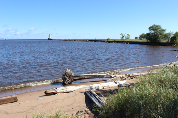
Island. The Pokegama Bay sections – north and south, comprising 6,699 acres – are the major areas of study and education within the Reserve. The heavily wooded inland portion runs parallel to Highway 101, stretching due east from the Town of Oliver to Cemetery Road and then northward to 28th Street. The final, discrete section of the Reserve – Wisconsin Point, the smallest section at 2,825 acres – includes most of Allouez Bay and the Point beach and dunes from the lighthouse towards Dutchman’s Creek, ending just west of Morrison Creek.
Conducting Research in the Estuary
Dr. Dustin Haines is the research coordinator for the Reserve. He coordinates scientific activity with visiting scholars, assisting them when necessary and working with them to publish their findings.
Particular to Haines’ role, and one of his core areas of research, is co-leading the Reserve’s System-Wide Monitoring Program and Sentinel Site Program with Monitoring Coordinator Hannah Ramage. What that basically entails, Haines explained in layman’s terms, is collecting a whole bunch of different parameters relating to water quality. “We have these data logging probes [called sondes] that are in the water at four locations, and every 15 minutes they’re collecting data on a whole suite of parameters relating to water quality,” he said. “That’s happening all the time, except for when ice is on the river, when we pull our probes out because the ice will crush them.”
Water quality monitoring is important, because the St. Louis River is designated as an AOC (Areas of Concern) by the U.S. Environmental Protection Agency. An AOC is defined by the U.S.-Canada Great Lakes Water Quality Agreement as ““geographic areas designated by the Parties where significant impairment of beneficial uses has occurred as a result of human activities at the local level.” There are currently 27 such areas on the Great Lakes in the United States. The Reserve’s work, Haines said, is “instrumental in helping them understand what the status of water quality is within the estuary, and whether or not it’s getting better or worse.” The long-range goal is to get the St. Louis River delisted as an Area of Concern.
Priority themes (for both Reserve staff and their partners’ research) are climate change, invasive species, pollutants, freshwater estuary research, species of special interest, restoration research and social science that improves understanding of the St. Louis River Estuary’s socioeconomic impacts.
A topic that grabs a lot of headlines throughout the Great Lakes basin, for good reason, is invasive species. Not only can they harm native animals, fish and plants; their negative impact “can result in huge economic impacts and fundamental disruptions of coastal and Great Lakes ecosystems,” says NOAA’s website. Scientists in the Reserve have done research on different types of invasive species, including aquatic plants, or emergent plants that live in wetlands, like purple loosestrife. Aquatic organisms like the Rusty Crayfish, Bloody Red Shrimp and the Round Goby are also receiving close scrutiny.
Through research on restoration, added Haines, restorative plants are studied to counter the impact of damage inflicted by invasive species such as the Emerald Ash Borer. Some of that focus is on wild rice, he noted, “where we’ve collaborated with people on various studies and trying to restore wild rice populations.”
The research conducted by Haines and his colleagues adds to a growing and vital body of information on water quality impacts through human interaction, an area of study broadly known as beneficial use impairments (or BUIs), defined as “a change in the chemical, physical or biological integrity of the Great Lakes system sufficient to cause significant environmental degradation.” A concern that Haines hopes to address even more is climate change and how extreme weather events impact the estuary – and the people who rely on the river and estuary.
Translating Research into Education
Teachers are the lifeblood of learning in our communities. As a publicly funded program, education and community outreach are some of the most important components of the Reserve. And Education Specialist Ryan Feldbrugge is passionate about providing relevant information to teachers and their students.
“Broadly speaking, my goals are to connect as many teachers and students as I can to this amazing place we call home, the St. Louis River estuary and Lake Superior, and get them excited about it and interested in it and working to keep it special,” he said.
Feldbrugge packages the complex details of research into effective learning modules for nonscientific audiences, specifically teachers, but is also inclusive of adult learners and community groups. He supports the Reserve’s Rivers2Lake program, which takes a cohort of 12 educators per school year through an in-depth exploration of the estuary, helping them use outdoor and place-based learning techniques they can take back to their schools and students. Teachers who apply for the program are accepted based on the strength of their application. Not surprisingly, competition is stiff, because Rivers2Lake has a highly successful reputation.
In a typical (pre-COVID-19 pandemic) cohort, Reserve staff “would probably take anywhere from two to six different field trips over the course of a school year with a given teacher,” Feldbrugge explained. “If they’re local classrooms, we’ll take them to places like the Superior Municipal Forest, right along the Pokegama River, or out to Wisconsin Point. We’ve done a fair number of trips out to the Superior School Forest and made use of their resources out there as well.” Field trips are also taken along Lake Superior’s south shore to the Northern Great Lakes Visitor Center in Ashland or the Port Wing slough.
“One of the goals is to get teachers comfortable teaching outside, and kids comfortable learning in the outdoor classroom, because of the inherent benefits that go along with it,” said Feldbrugge.
Local Relevance – Always
Local relevance. That’s something the Reserve stresses in every aspect of its existence. “This is really accomplished by pulling people together, creating the partnerships that shape the core of the Reserve,” said Erickson. “The role of the education program is to take real research that is happening right now and bring it to people’s lives and show why it’s relevant – and show how we can make more informed decisions because of what we’re learning and studying.”
For that reason, she is proud that the Rivers2Lake program is immensely successful. The Reserve’s education initiatives also reach into the general community, specifically with “River Talks” – events she describes as “science café-style informal talks from scientists about the work they’re doing.” There is also an early childhood nature playgroup in the summer “for little ones to come and get dirty and learn a lot about the St. Louis River,” Erickson noted of playgroup goals to mix fun with education.
In addition, there’s the Lake Superior Estuarium at Barker’s Island. Thanks to support from the University of Wisconsin-Madison Division of Extension as well as NOAA, the Reserve renovated a formerly disused building to serve as its public science and interpretive learning center, which is visited by tourists, area residents and students. This exhibit hall provides an inclusive, family-centered space to tell the story of the St. Louis River and the Lake Superior watershed and coasts.
Since it is a publicly funded entity, Erickson wants the community to feel ownership in the Reserve. Part of her mission as program manager is to get the word out – to make sure people feel connected. The Reserve is the “center of the wheel,” she said, that draws everyone together She invites anyone interested in the estuary, the river or the lake to learn more at lakesuperiorreserve.org. When pandemic restrictions ease, Erickson also invites people to visit, tour their lab, explore the Estuarium and participate in volunteer activities through the Friends of the Lake Superior Reserve organization. An Annual St. Louis River Summit is also held, where everybody doing work on the river convenes for a conference to talk about and share ideas.
New Funding: Pokegama River Public Boat Launch
and Microplastics Research
The team at the Lake Superior National Estuarine Research Reserve has so much to share through the research team members are doing. In 2019 alone, it engaged 506 coastal decision makers in training sessions, reached 1,522 students through the popular Rivers2Lake education program and provided teachers with 938 hours of professional development. Since 2012, it has monitored estuary health through 3.5 million water quality data points.
The success of this organization’s programs and initiatives has resulted in well-deserved support over the years, including grants. In July, for example, Lorena Rios Mendoza, a UW-Superior associate professor of chemistry, as well as colleagues from UW-Eau Claire, UW-Madison and the Reserve, were awarded a more than $40,000 grant by the Freshwater Collaborative of Wisconsin to study microplastics in western Lake Superior and the St. Louis River Estuary. Microbeads, plastic fibers and microplastics are found in water worldwide. These tiny plastic particles attract toxins. They’re also eaten by aquatic bugs and fish – and those fish may end up consumed by people. In 2018, Wisconsin Public Radio reported that the national park with the highest microplastics concentration was the Apostle Islands in Northern Wisconsin, and that researchers have found microplastics in beer made with Great Lakes water. Microplastics have also been found in Minnesota’s Boundary Waters Canoe Wilderness area.
And in late September, UW-Superior announced that thanks to a $128,482 NOAA grant awarded to the Research Reserve, in partnership with the City of Superior, the city will improve a rustic boat launch on the Pokegama River in the Superior Municipal Forest along Billings Park Drive. Improvements include a dock, motorized boat launch pad, vault (no running water) restroom facility, improved parking spaces, a separate kayak and canoe launch access, interpretive signs, trash and recycling facilities and road improvements to reduce clay erosion into the river. The City of Superior will contribute roughly $50,000 for the garbage and recycling cans and restroom facility.
The design for this project was completed by Superior-based AMI Consulting Engineers last year, and design funding was made possible with a Wisconsin Department of Administrative Coastal Management Program Grant. UW-Superior’s news release noted that “The site is a primary research and education program location in the Lake Superior National Estuarine Research Reserve and is one of two Superior stops on the proposed St. Louis River Estuary National Water Trail. The Douglas County Fish and Game League, St. Louis River Alliance, and Northland Paddlers Alliance also provided support for the proposal.”
So when you drive past Barker’s Island and see the Research Reserve’s blue metal and brick-red waterfront buildings, be assured that these facilities are here for all. And they’re there for the betterment of our greatest natural resources.
A great way to support the Research Reserve is to join Friends of the Lake Superior Reserve, a nonprofit that raises funds and volunteers by conducting activities such as a clean-the-beach event in September to support Coastal Awareness Month and National Estuaries Day. Visit folsr.org for more information. Donations to the Lake Superior Reserve fund, which is managed by the University of Wisconsin Foundation, are also gratefully accepted. PS
Patrick Lapinski is a freelance writer who grew up in Superior.