The new Blatnik Bridge will stretch farther, stand taller and be built to last a century. But getting there will mean years of construction, a closure expected to last up to 56 months, and a fundamental reshaping of how people and freight move between Superior and Duluth.
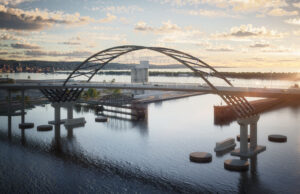
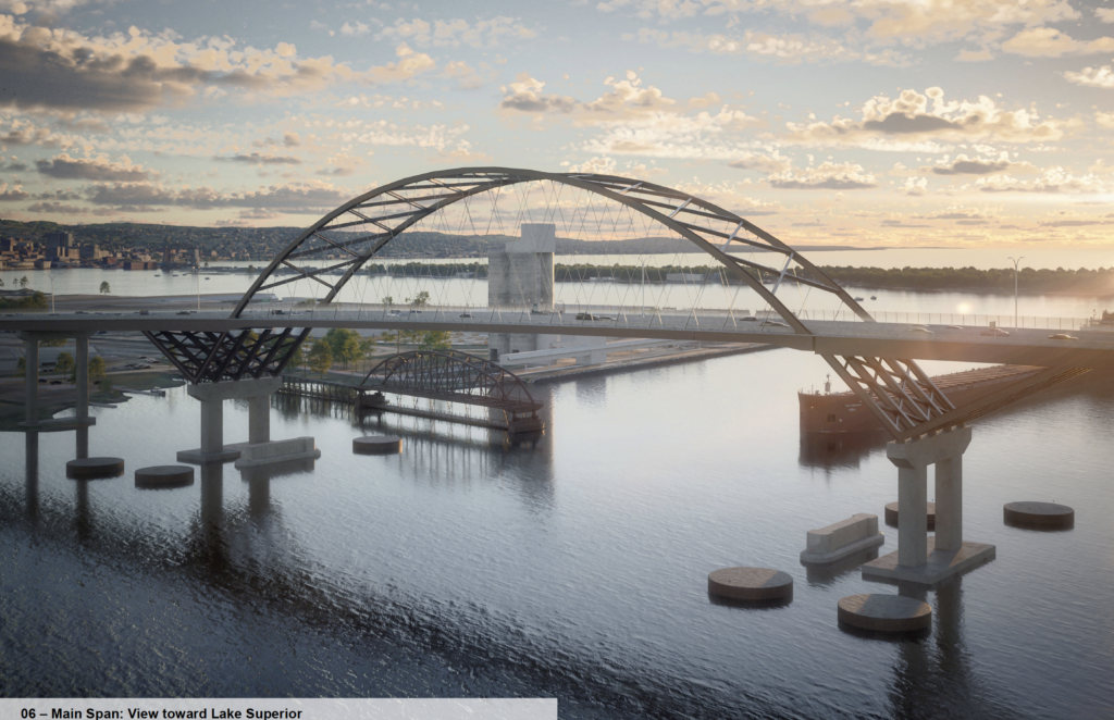
At a public meeting Aug. 12, officials from MnDOT and WisDOT pulled back the curtain on the chosen design: a tied-arch “delta frame” bridge rising over the St. Louis Bay, with wider spans, modern ship protection and a separated 12-foot wide path for people on foot and bike.
The project, six years in the making, is now entering its most visible phase.
Why the New Blatnik Will Stand Where the Old One Does
One of the most persistent public questions has been why the new bridge won’t be built alongside the old one to keep traffic moving.
MNDOT project manager Pat Huston explained that during the environmental review, they studied “dozens of options,” including a parallel structure. In the end, building on the existing alignment:
- Reduces impacts to adjacent properties and wetlands
- Cuts risk by avoiding construction inches from live traffic on a massive bridge
- Saves an estimated $80–$100 million
- Allows a single, more efficient construction phase, shaving nearly a year off the schedule
He also pointed to a recent Mississippi River project where building beside an active bridge led to foundation settlement and an early, unplanned closure — a risk they say this project is designed to avoid.
“This didn’t get decided lightly,” Huston told the crowd of about 150, emphasizing that “we let the numbers do the talking and the data make the decisions.”
Design-Build and a Bridge Chosen on “Best Value”
The Blatnik is being delivered as a design-build project, meaning MnDOT and WisDOT advanced the design only to about 30 percent before handing it to competing contractor teams. Those teams then refined the design within a framework of performance-based specifications and project goals.
Two groups went head-to-head: Lunda Construction with Michael Baker as engineers, and the Ames Kramer–HNTB joint venture. Instead of a simple low-bid contest, the agencies used a best-value formula that scored teams on safety, quality, schedule and how well they could minimize construction impacts to motorists, ship traffic and nearby communities.
Both proposals scored high technically, but Ames Kramer’s tied-arch “delta frame” concept came in significantly lower in price than Lunda’s cable-stayed alternative, giving it the winning edge.
What the New Bridge Will Look and Feel Like
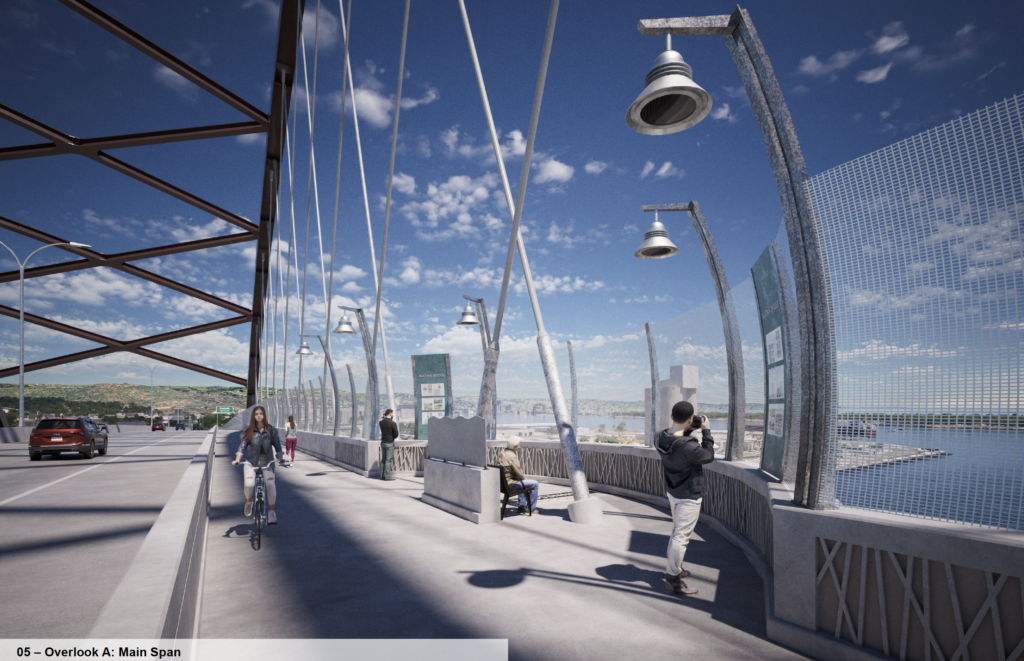
Renderings and a fly-through video showed a structure that’s recognizably a working bridge, but with updated lines and a more deliberate nod to people who aren’t in cars.
Key features include:
• 12-foot traffic lanes and full shoulders, improving safety and giving room for stalled vehicles and responders.
• A 12-foot shared-use path for pedestrians and cyclists, with five overlooks, including a larger center-span overlook. Interpretive signs are planned to tell the story of the harbor and region.
• The path will be built robustly enough for bridge inspection equipment and emergency vehicles, reducing the need for lane closures and providing an alternative route in case of a blockage on the traffic deck.
• Weathering steel and a redundant structural system, designed so that no single failure would likely bring down the bridge — a contrast to older “fracture critical” designs.
• Modern pier protection using large round “dolphins” built to handle the much more massive ships now common on the Great Lakes.
Nighttime images showed a restrained lighting scheme — a single color, softly washing the arch and key elements — chosen in part to protect dark skies and wildlife.
“It’s meant to have that classic, timeless glow,” Huston said, adding that the project’s Visual Quality Committee will continue to refine the details with the contractor’s own design specialists.
A Project Measured in Years, Not Months
The schedule is long and complicated, but a few milestones stand out:
• Final design is underway and expected to continue through December 2027.
• Demolition of the existing main span is currently penciled in for the fall/winter of 2027–28, timed around shipping season and subject to further negotiation with the U.S. Coast Guard.
• Substructure work — the hidden but critical work of pile driving, footings, and piers — runs roughly from mid‑2027 to mid‑2029.
• Superstructure and roadway construction continues into 2031.
• The agencies have set October 31, 2031 as the latest “substantial completion” date for reopening the crossing, with punch-list work and landscaping into spring 2032.
A contract limit caps the full closure to no more than 56 months, with incentives available for finishing earlier. But officials were explicit: they do not want those incentives to push contractors into unsustainable, round-the-clock schedules that contribute to burnout and mental health problems among workers.
“People build these bridges,” Huston said, sharing that national discussions about suicide and mental health in the construction trades influenced how they shaped the schedule and incentives.
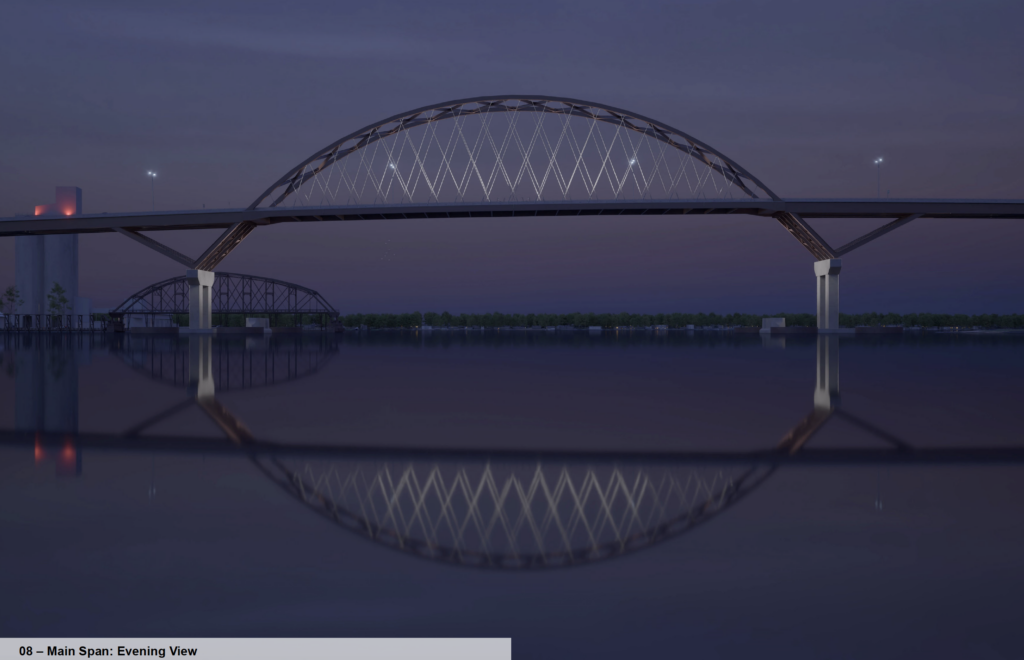
A subtle nighttime lighting design.
Local Streets, Winter Street and the Daily Commute
For residents and businesses in Superior and Duluth, the most immediate impact will be on local streets once traffic that now crosses the Blatnik is funneled to other routes.
Traffic modeling shows heavier volumes on I‑35, the Bong Bridge, and key corridors through Superior, with particular pressure points near the Highway 2 roundabout and along Winter Street.
To manage that, agencies are rolling out a Winter Street mitigation package:
• Resurfacing Winter Street and improving it so it’s an attractive, functional alternate route.
• Adding turn lanes and widening at critical intersections, including at Susquehanna Avenue.
• Limiting some left turns near the Banks/Ogden area to prevent left-turn backups from freezing through traffic.
• Installing temporary traffic signals on the Duluth side, including at the junction of Highway 2 and I‑35 ramps, in coordination with St. Louis County’s own project.
• Using cameras and active monitoring around the Highway 2 roundabout and other hot spots to adjust signal timing, signing, and restrictions in real time.
Officials were candid that the first weeks after closure will be messy as drivers experiment with new routes. They promised close coordination with the City of Superior, law enforcement and local businesses, and stressed that adjustments would be ongoing, not one-and-done.
“You’re going to have to be patient with us,” said WISDOT Project Manager Paul Conlin, adding that the team has “all the tools” — from engineering models to on-the-ground observation — but will still be learning alongside the public how traffic actually behaves.
A New Icon — and a Big Ask
Beyond traffic models and pier designs, the new Blatnik is poised to reshape how the region presents itself to visitors. The widened shared-use path and overlooks open up the possibility of a new vantage point on the port, and planners have already eyed nearby land for stormwater ponds, snow storage and trail connections that could double as a trailhead and public space.
For now, though, the looming reality is disruption: years of rerouted commutes, questions about access for emergency services and freight, and worry from business owners along the corridors that will absorb diverted traffic.
Project leaders say they’ll measure their success not just by the bridge they build, but by how well they manage those years in between.